Question

Image

Answer

figure shows paddy fanning in India. The farmers are planting paddy. The water logged fields are shown.

Need a full question paper?

Generate a complete, print-ready paper with questions like this in minutes — across 16+ boards, with answer keys.

Start Generating Free

Similar questions

Show the following on an outline of the world map.
(a) Name all the continents and oceans of the world.
(b) Colour Brazil and India using different colours and name them.
(c) Draw equator on the map and write its value in degrees.
(d) Show the symbol for direction.

Image

Image
(1) In which part of Brazil are the average temperatures low?
(2) Identify the rain-shadow area in Brazil. Describe its climatic characteristics.
(3) In which region do you find a higher temperature?
(4) Considering the latitudinal extent of Brazil, where will you find a temperate climate in Brazil?
(5) Describe the winds blowing between 0° to 5° N and S zones?
(6) Which method has been used to show distribution in this map?

Image

Image
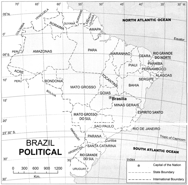
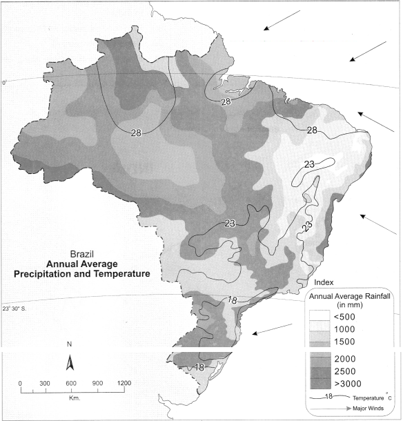
(1) Considering the isotherms of Brazil, what is the average range of temperature in Brazil?
(2) In which area does it rain more?
(3) From which directions are winds blowing towards Brazil?
(4) What could be the reason behind that?
(5) What could be the obstruction in the way of these winds?
(6) Which type of rainfall will occur because of these winds?
(7) Correlate these winds and rainfall?


Image
Identify Brazil’s neighbouring countries and oceans. Complete the following table.

Image

(a) To the North
(b) To the South
(c) To the East
(d) To the West


Image

Image
Image
Questions:
(1) What does the given map show ?
(2) Name the Southernmost point of India.
(3) What is the East-West distance of India?
(4) Which longitude in India is called the Indian Standard Time?
(5) Name the Sea to the West of India.