ICSE BoardEnglish MediumSTD 6GeographyElements of a Map2 Marks
Question
What is meant by the scale of a map?
✓
Answer
The scale on a map is the distance shown on the map. The scale is given just below the map. The scale helps us to find out the correct distance between various points on a map. On a scale, there is always a proportion between the dimension of the map and the actual area they represent.
Need a full question paper?
Generate a complete, print-ready paper with questions like this in minutes — across 16+ boards, with answer keys.
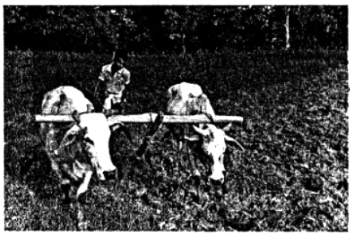
Picture study The photograph here shows a farmer tending to his field. 1. What type of farming is he practicing? 2. What are the difficulties that he might face?