Question 14 Marks
Write two characteristics of this type of settlement.
Answer
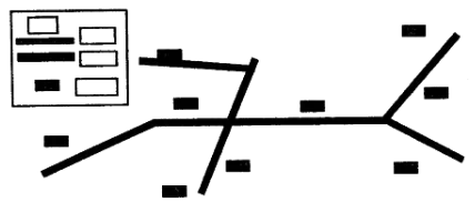
View full question & answer→Linear settlements are those settlements that develop in a line. Houses, shops, dhaba’s, petrol pumps and garages develop along the sides of the roads, railway lines or river banks. Gradually, these linear settlements grow in size. These settlements gradually develop into trading centers.
Examples: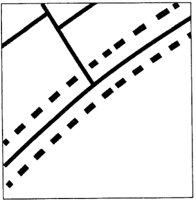
Scattered settlements are also known as dispersed settlements. Houses or huts in this type of settlement are far apart from one another. On map, such settlement is indicated by long distances between houses. Such areas show sparse population and the absence of proper roads. Houses or huts are usually connected by cart tracks or paths. Cattle rearing is common as each household has cattle that is allowed to graze in the open fields. The land is not very fertile to support big populations.
Examples:
- If such a settlement is near a railway track, and over a period of time, a need for a railway station is felt, then it becomes a railway stop.
- When located on main roads, such settlements become important stops for travellers as dhaba’s, tyre and car repairing shops and petrol pumps open up.
- On rivers and coasts, they become places where boats can unload goods and passengers.
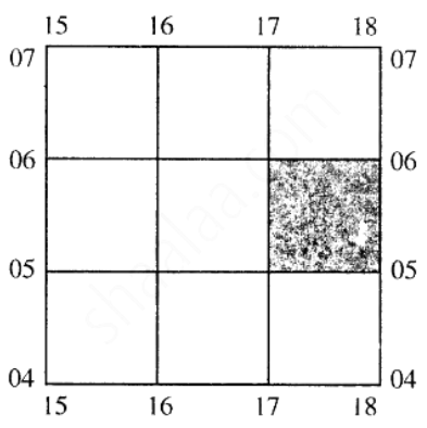
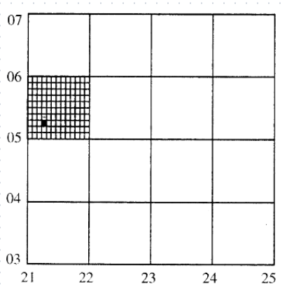
Scattered settlements are also known as dispersed settlements. Houses or huts in this type of settlement are far apart from one another. On map, such settlement is indicated by long distances between houses. Such areas show sparse population and the absence of proper roads. Houses or huts are usually connected by cart tracks or paths. Cattle rearing is common as each household has cattle that is allowed to graze in the open fields. The land is not very fertile to support big populations.