Question 14 Marks
Questions:
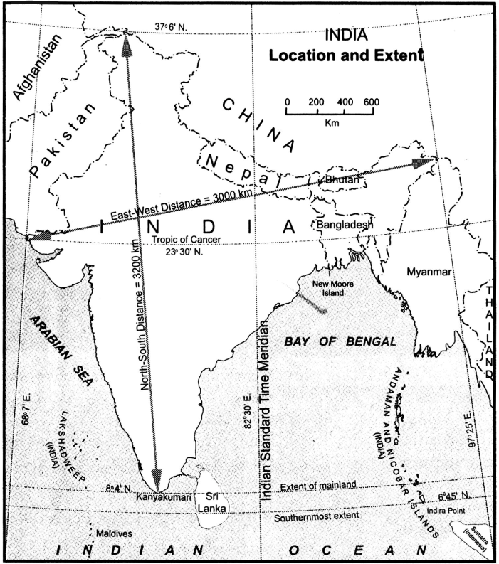
(1) What does the given map show ?
(2) Name the Southernmost point of India.
(3) What is the East-West distance of India?
(4) Which longitude in India is called the Indian Standard Time?
(5) Name the Sea to the West of India.
Answer
View full question & answer→1. The map shows the Location and Extent of India.
2. Indira Point (located at $\left.6^{\circ} 45^{\prime} N \right)$.
3. The East-West distance 3000 km of India.
4. Arabian Sea to the West of India.
5. $82^{\circ} 30^{\prime} E$ longitude in India is called the Indian Standard Time.
2. Indira Point (located at $\left.6^{\circ} 45^{\prime} N \right)$.
3. The East-West distance 3000 km of India.
4. Arabian Sea to the West of India.
5. $82^{\circ} 30^{\prime} E$ longitude in India is called the Indian Standard Time.