Questions · Page 1 of 2

[1 Mark Questions]

🎯

Test yourself on this topic

50 questions · timed · auto-graded

Question 11 Mark
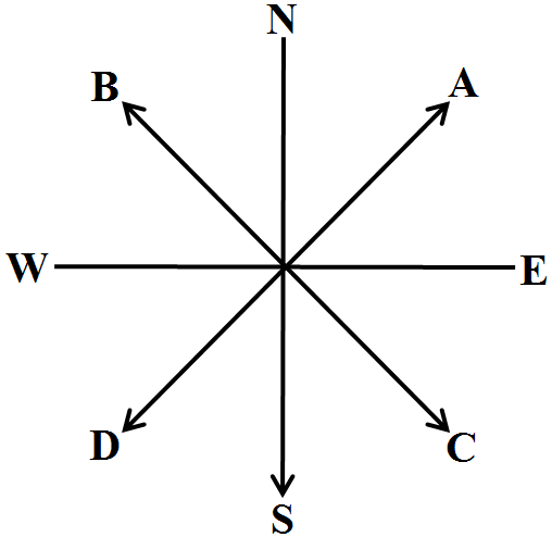
What is the easiest way to remember compass directions?
Answer
The earth rotates west to east, so the sun rises in the east and sets in the west. No matter which side one is facing, east is the morning sun and west is the evening sun or night time.
View full question & answer
Question 21 Mark
What are political maps?
Answer
Maps showing cities, towns and villages and different countries and states of the world with their boundaries are called political maps.
View full question & answer
Question 41 Mark
Define political maps.
Answer
Map which shows cities, towns, villages, different countries and states of the world with their boundaries are called political maps.
View full question & answer
Question 71 Mark
What is a sketch?
Answer
A sketch is a rough drawing mainly based on memory and spot observation and not to scale.
View full question & answer
Question 91 Mark
What do you mean by the term ‘the scale of the map’?
Answer
The scale of a map is the ratio between the actual distance on the ground and the distance shown on the map.
View full question & answer
Question 101 Mark
What are physical or relief maps?
Answer
Maps showing natural features of the earth such as mountains, plateaus, plains, oceans, rivers, etc. are called physical or relief maps.
View full question & answer
Question 111 Mark
Define a map.
Answer
A map is a representation or a drawing of the earth's surface or a part of it drawn on a flat surface according to a scale.
View full question & answer
Question 131 Mark
Write about the shortcomings of a globe?
Answer
A globe cannot show as many details as a map can. It does not give details of any country and details like districts, states, town or villages. It is also heavy and difficult to carry around.
View full question & answer
Question 141 Mark
What are Thematic maps?
Answer
Some maps focus on specific information such as road maps, rainfall maps, maps showing distribution of forests, industries, etc. are known as thematic maps.
View full question & answer
Question 161 Mark
What is thematic map?
Answer
Some maps focus on specific information such as road maps, rainfall maps, distribution of forests, industries etc. These are called thematic maps.
View full question & answer
Question 171 Mark
Suppose a person is walking towards north and he takes left hand turn. Now he is moving in which direction?
Answer
West.
View full question & answer
Question 181 Mark
On a map, the scale given is 1cm = 10km. On the map the distance between your home and the temple is 3cm then what will be the distance between temple and your home?
Answer
30km.
View full question & answer
Question 191 Mark
Name the three components of a map.
Answer
Three components of a map are direction, distance between two places, conventional signs and symbols.
View full question & answer
Question 291 Mark
What are conventional symbols?
Answer
Conventional Symbols are symbols that are used on maps to represent different features.
View full question & answer
Question 321 Mark
How can maps be helpful in emergencies?
Answer
They can be useful by providing valuable information regarding routes or places for hiding in case of emergencies or rescue operations.
View full question & answer
Question 341 Mark
What are the four cardinal directions?
Answer
The four cardinal directions are: North, South, West and East.
View full question & answer
Question 351 Mark
What is a small scale map?
Answer
When large areas like countries or continents to be shown on a paper, then we use a small scale. For example, 5cm on the map shows 500km of the ground. It is called a small scale map.
View full question & answer
Question 361 Mark
If we have to find a city in the state of Andhra Pradesh, what type of map we will look for?
Answer
Political map.
View full question & answer
Question 381 Mark
How do symbols help in reading maps?
Answer
Symbols are an important part of a map. They give a lot of information in a limited space. With the use of symbols maps can be drawn easily and are simple to read. Even if we don’t know the language of an area and therefore cannot ask someone for directions. We can collect information from maps with the help of symbols.
View full question & answer
Question 411 Mark
What is a sketch?
Answer
Sketch is a drawing mainly based on memory and spot observation and not according to scale.
View full question & answer
Question 421 Mark
Why do we use colours on the maps?
Answer
Different colours are used on the map for presenting different things or objects.
View full question & answer
Question 431 Mark
What are conventional symbols?
Answer
There is an international agreement regarding use of the symbols on maps. Symbols, fixed through International agreement, are called conventional symbols.
View full question & answer
Question 451 Mark
Give the name of intermediate directions.
Answer
Intermediate directions are – North-East(NE), South-East(SE), South-West (SW), and North-West (NW).
View full question & answer
Question 461 Mark
What do you know about cardinal points?
Answer
Major directions – North, South, East and West are called cardinal points.
View full question & answer
Question 501 Mark
Why is scale needed in the map formation?
Answer
A scale is needed to represent a large distance in a small distance on paper.
View full question & answer
[1 Mark Questions] - Social Science STD 6 Questions - Vidyadip