Question
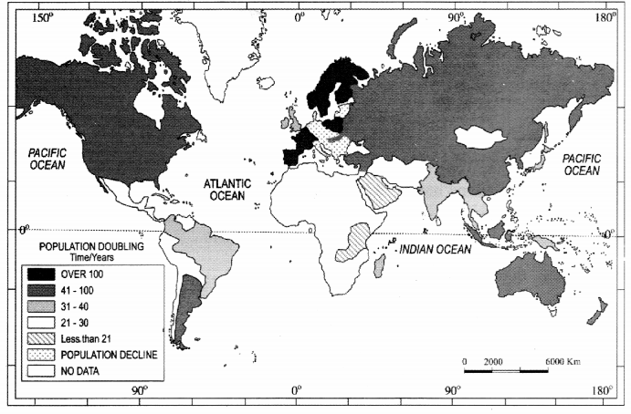
Study the given map and answer the following questions:
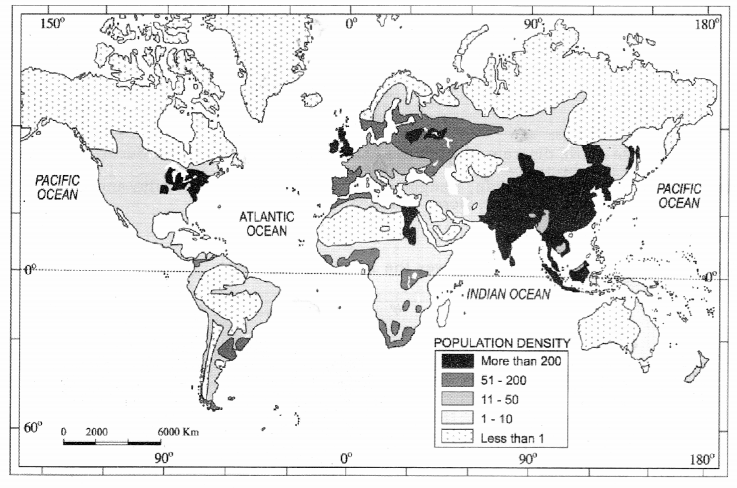
(i) Name the nations having high density of population in Asia.
(ii) Name the nations having less than one person of population density.
(iii) Give appropriate reasons for the above two questions.
(i) Name the nations having high density of population in Asia.
(ii) Name the nations having less than one person of population density.
(iii) Give appropriate reasons for the above two questions.