Question
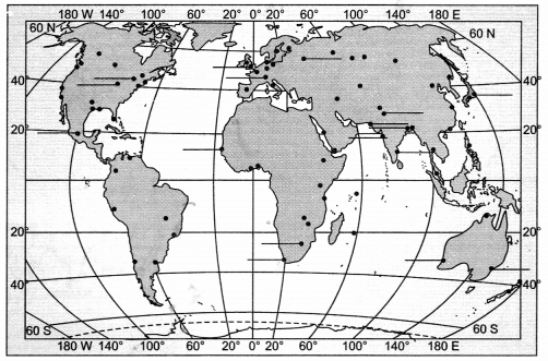
Study the given map and answer the following questions:
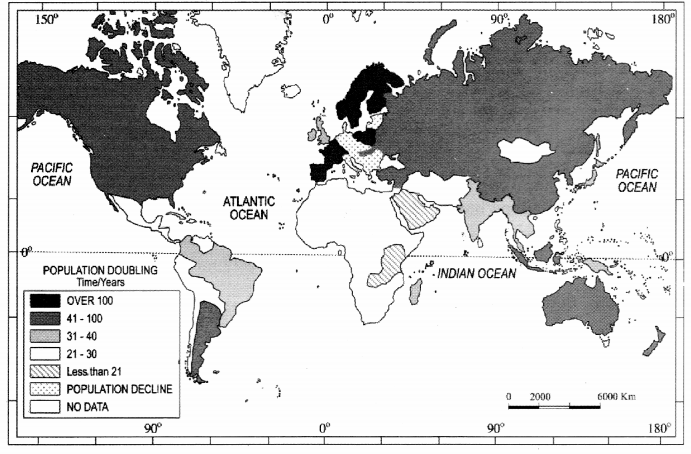
(i) Name the nations that take a very long time to double their population? Why?
(ii) Which are the nations taking about 31 to 40 years to double their population? Why?
(i) Name the nations that take a very long time to double their population? Why?
(ii) Which are the nations taking about 31 to 40 years to double their population? Why?