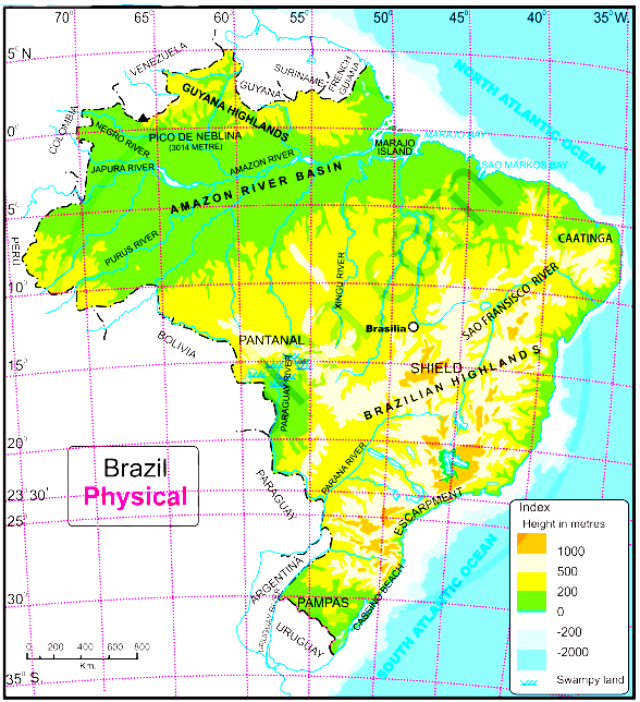
Question 15 Marks
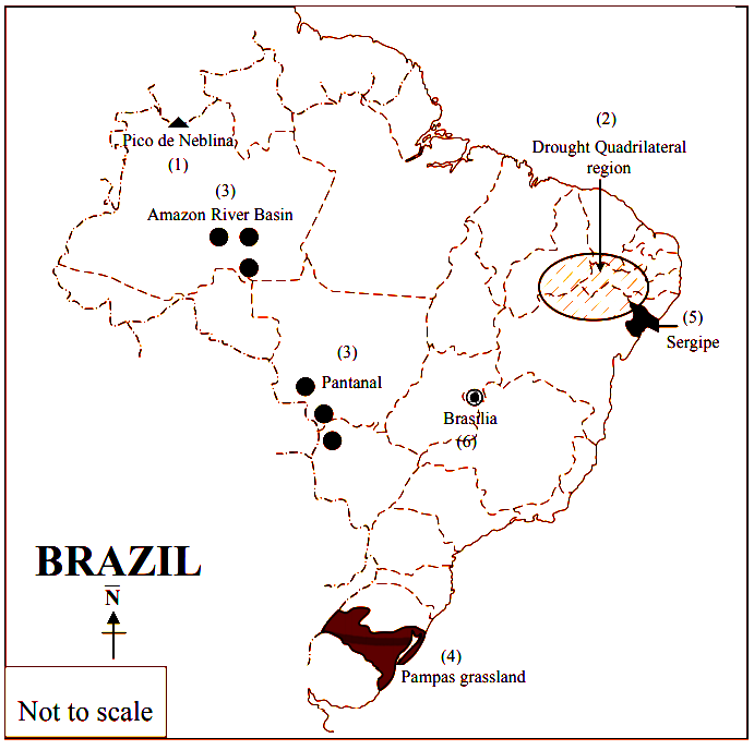
Show the following in the outline map of Brazil with index.
- Condor
- The northernmost state of Brazil with less population density
- The southernmost state of Brazil which produces soyabean
- Victoria port
- Rio de Janerio-a tourist place
- Brasilia airport
Answer
View full question & answer→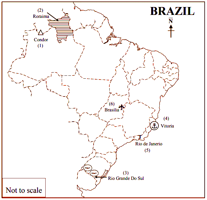
INDEX
| Q. No. | Symbols | Details |
| 1. | Δ | Condor |
| 2. |  | The northernmost state of Brazil with less population density- Roraima |
| 3. |  | The southernmost state of Brazil which produces soyabean - Rio Grande Do Sul |
| 4. |  | Vitoria port |
| 5. | T | Rio de Janerio-a tourist place |
| 6. |  | Brasilia airport |