Question
| Agent | Processes | Erosional / Deposition features |
| (1) River | (1) Plucking | (1) Hollows |
| (2) Wind | (2) Solution | (2) Potholes |
| (3) Glacier | (3) Deflation | (3) Sinkholes |
| (4) Groundwater | (4) Drilling | (4) Roche moutonnees |
| Agent | Processes | Erosional / Deposition features |
| (1) River | (1) Plucking | (1) Hollows |
| (2) Wind | (2) Solution | (2) Potholes |
| (3) Glacier | (3) Deflation | (3) Sinkholes |
| (4) Groundwater | (4) Drilling | (4) Roche moutonnees |
| Agent | Processes | Erosional / Deposition features |
| (1) River | (1) Drilling | (1) Potholes |
| (2) Wind | (2) Deflation | (2) Hollows |
| (3) Glacier | (3) Plucking | (3) Roche moutonnees |
| (4) Ground water | (4) Solution | (4) Sink holes |
Generate a complete, print-ready paper with questions like this in minutes — across 16+ boards, with answer keys.
| Measures | Pre-disaster/ Post-disaster | Structural or Non-Structural |
| (1) Community level disaster planning | (1) Post-disaster | (1) Structural |
| (2) Providing financial support | (2) Post-disaster | (2) Structural |
| (3) Rebuilding of roads and bridges | (3) Pre-disaster | (3) Non-structural |
| (4) Providing houses to affected people | (4) Pre-disaster | (4) Non-structural |
| A | B | C |
| (1) Different density of corals in summer and winter | (1) Ice cores | (1) Understanding of past environmental conditions |
| (2) Variation in environmental conditions | (2) Goldilocks Zone | (2) Summer snow different from winter snow |
| (3) Samples of ice from inner sides of the ice sheets | (3) Creates seasonal growth rings on corals | (3) Earth was cooler when it was located in the outer reaches of this zone |
| (4) Habitable zone in which the Earth lies | (4) Tree rings | (4) Determines the temperature of water and season in which coral grew |
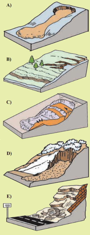
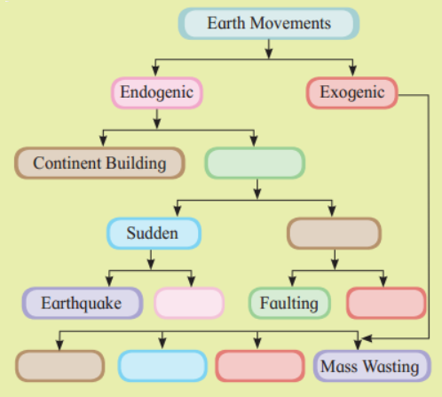
| Types of Mass | Wasting Characteristics | Regions |
| (1) Creep | (1) Rapid fall | (1) Periglacial or alpine region |
| (2) Rockfall | (2) Slowest moving | (2) Hillsides in a humid region |
| (3) Earth flow | (3) Slow downhill creep | (3) Rocky areas |
| (4) Solifluction | (4) Rapid or slow | (4) Tops and basal portions of hills |
| A | B | C |
| (1) Boreal forest | (1) Hardwood species of tree | (1) Siberia |
| (2) Deserts | (2) Tropical deciduous forest | (2) Myanmar |
| (3) Teak | (3) Wide spectrum of bio-diversity | (3) Sahara Desert |
| (4) Tropical rainforest | (4) Tundra region | (4) Brazil |
| (5) Taiga forest | (5) Greenland | |
| (6) Narrow spectrum of bio-diversity |
| A | B | C |
| (1) Continental Shelf | (1) Deeper Part | (1) Manganese Nodules |
| (2) Oceanic Microorganisms | (2) Abyssal Plains | (2) Whales |
| (3) Oceanic Trenches | (3) Fishing | (3) Sunda |
| (4) Vast Flat Area | (4) Plankton | (4) Dogger Bank |
| Measures | Pre-disaster/ Post-disaster | Structural or Non-Structural |
| (1) Public awareness | (1) Post-disaster | (1) Structural |
| (2) Preparedness of hospital | (2) Post-disaster | (2) Non-structural |
| (3) Providing food and shelter to people | (3) Pre-disaster | (3) Structural |
| (4) Construction of river embankments | (4) Post-disaster | (4) Non-structural |
| A | B | C |
| (1) P-waves | (1) Ring of Fire | (1) Indonesia |
| (2) Volcanic eruption | (2) Shadow zone | (2) Italy |
| (3) Cinder cone | (3) Smoke | (3) Cauliflower cloud |
| (4) Tectonic movements | (4) Mt. Nuovo | (4) Cotopaxi |
| (5) Circum pacific belt | (5) Convergent and divergent margin | (5) Between 105° and 140° |
| A | B | C |
| (1) the Mediterranean | (1) 40° to 50° N and S | (1) Maple, elm, walnut, deodar |
| (2) Temperate Deciduous | (2) 40° to 55° N and S | (2) Willow, alder, poplar, various species of grasses |
| (3) Temperate Grassland | (3) 30° to 40° N and S | (3) Pine, oak, cedar, rosemary |