Question
Mention the important features of a river valley.

Answer

The shape of contours enable to identify the different features of a river valley. The important features of a river valley are as follows:
Direction of river: It can be found out by studying the general slope of the land. A river always flows from a higher level to lower level, so in whichever direction the land is sloping the river will flow in that direction all the small streams also join the river in the same direction.
Features of a river :
(a) Seasonal non - perennial streams - These dry up in summers and occur in rainy season specially in arid region.

(b) Stream (nallah) or nads.

(c) River (dry) if spwckled shows dry , if coloured blue shows perennial.

(d) River dry with water channel.

(e) River with islands and Rocks.

(f) Disappearing Streams.

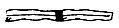
(g) confluence is where the tributary meets the main river.

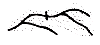
(h) Meander is a bend in the river flowing through a plain.


(i) Broken ground - Generally found along the banks of a streame or river in arid regions where the top soil gets eroded due to flooding during rainy season. This type of land is uncultivable.
(j) River Bank steep 3r meters.

Need a full question paper?

Generate a complete, print-ready paper with questions like this in minutes — across 16+ boards, with answer keys.

Start Generating Free

Similar questions

Himalayan Rivers and Peninsular Rivers.
Study the extract of the Survey of India Map sheet No. 45D/10 and answer the following questions:
(a) 
Give the six figure grid reference of:
(i) Triangulated height 307.
(ii) The spot height 196.
(b) 
Give the four figure grid reference of each of the following:
(i) The confluence of the Sipu River and the Mahadeviyo Nala.
(ii) Sheet rock.
(c) Measure the shortest distance in kilometres between the temple in, grid square 8192, and the perennial lined well at Bhakodar 8188.
(d) 
What do the following represent?
(i) Black curved lines in 7788.
(ii) The blue line in the bed of the Sipu River.
(e) 
(i) What is the general pattern of settlements in the region shown on the map?
(ii) Give a reason for your answer.
(f) Which is the chief form of irrigation shown in the map extract? Why is it necessary?
(g) 
(i) What is the main form of transport in this region?
(ii) Give the map evidence for your answer.
(h) 
(i) What is the compass direction of Dantiwada, 8582, fromBhadli Kotha, 7886?
(ii) What is the general direction of flow of the Arado. N?
(i) 
(i) Name the type of drainage pattern found in grid square 8584.
(ii) What do you mean by 25r in grid square 8286?
(j) 
(i) What is meant by ‘R.F.’?
(ii) What is the R.F. shown on this map extract?
Give one use of each: teak, sal, myrobalan, sisam, sandalwood, eucalyptus.
Study the extract of the Survey of India Map sheet No. 45D/10 and answer the following questions:
(a) Give the six figure grid reference of:
(i) Triangulated height 217
(ii) A lined well near Chekhla.
(b) 
(i) Name the left bank tributary of the main river.
(ii) State the direction in which this left bank tributary is flowing.
(c) 
(i) Mention a special feature associated with the streams in grid square 9879.
(ii) Name the types of drainage pattern found in grid square 9382.(d) Give the four grid reference of each of the following:
(i) Open scrub
(ii) Bantawada.
(e) Name two relief features that can be seen in grid square 9782 and 9574.
(f) Why do you find limited cultivation in the map extract?
(g) What is the compass direction of Antroli (9576) and Chekhla (9281) from Sangla?
(h) What type of rainfall is experienced in the region shown in the map extract? Justify your answer giving one reason.
(i) Calculate the distance in kilometres along the cart track between Chitrasani (999747) and Pirojpura (978753).
(j) 
(i) What is the geographical name that you would give to the general pattern of settlements in the region shown on the map?
(ii) Name one region shown on the map which is unsuitable for the cultivation of crops.
What are the factors that favour the location of jute industry in the Ganga-Brahmaputra delta?
In the context of the Indian agriculture, answer the following:
How has the consolidation of land holdings helped the farming community?
Explain the stages involved in secondary treatment of water.
The Eastern Coastal Plain and Western Coastal Plain.
Name the rivers, falling in Arabian Sea and Bay of Bengal.
Show the different drainage patterns.